
Midland ZIP Code Directory Coverage
The Texas Geographic Program associates eight ZIP codes with Midland: 79701 through 79708. The USPS city-label list adds 79710, 79711, and 79712. Together, those eleven ZIP codes are the practical Midland set for postal research. The available sources do not supply official neighborhood boundaries for each one. Entries marked as an association should not be expanded into an unverified part-of-town boundary.
| ZIP | Documented Midland connection | Postal location | Research note |
|---|---|---|---|
| 79701 | Midland association | Downtown Midland | Downtown location uses 79701-9998 |
| 79702 | Midland association | Not separately identified | Common county mailing ZIP |
| 79703 | Midland association | Not separately identified | Verify a specific delivery address with USPS |
| 79704 | Midland association | Not separately identified | Verify a specific delivery address with USPS |
| 79705 | Midland association | Claydesta | Claydesta uses 79705-9998 |
| 79706 | Midland association | Not separately identified | County facilities and outlying delivery addresses can use it |
| 79707 | Midland association | Not separately identified | Some HOA results use it; that is not a boundary |
| 79708 | Midland association | Not separately identified | Exact delivery use needs address verification |
| 79710 | USPS label-list association | Not separately identified | Exact local delivery geography was not located |
| 79711 | USPS label-list association | Midland GMF | GMF uses 79711-9996 and 79711-9998 |
| 79712 | USPS label-list association | Not separately identified | Exact local delivery geography was not located |
Use a USPS city-label listing to confirm the broader association, then use a street address for the final delivery check.
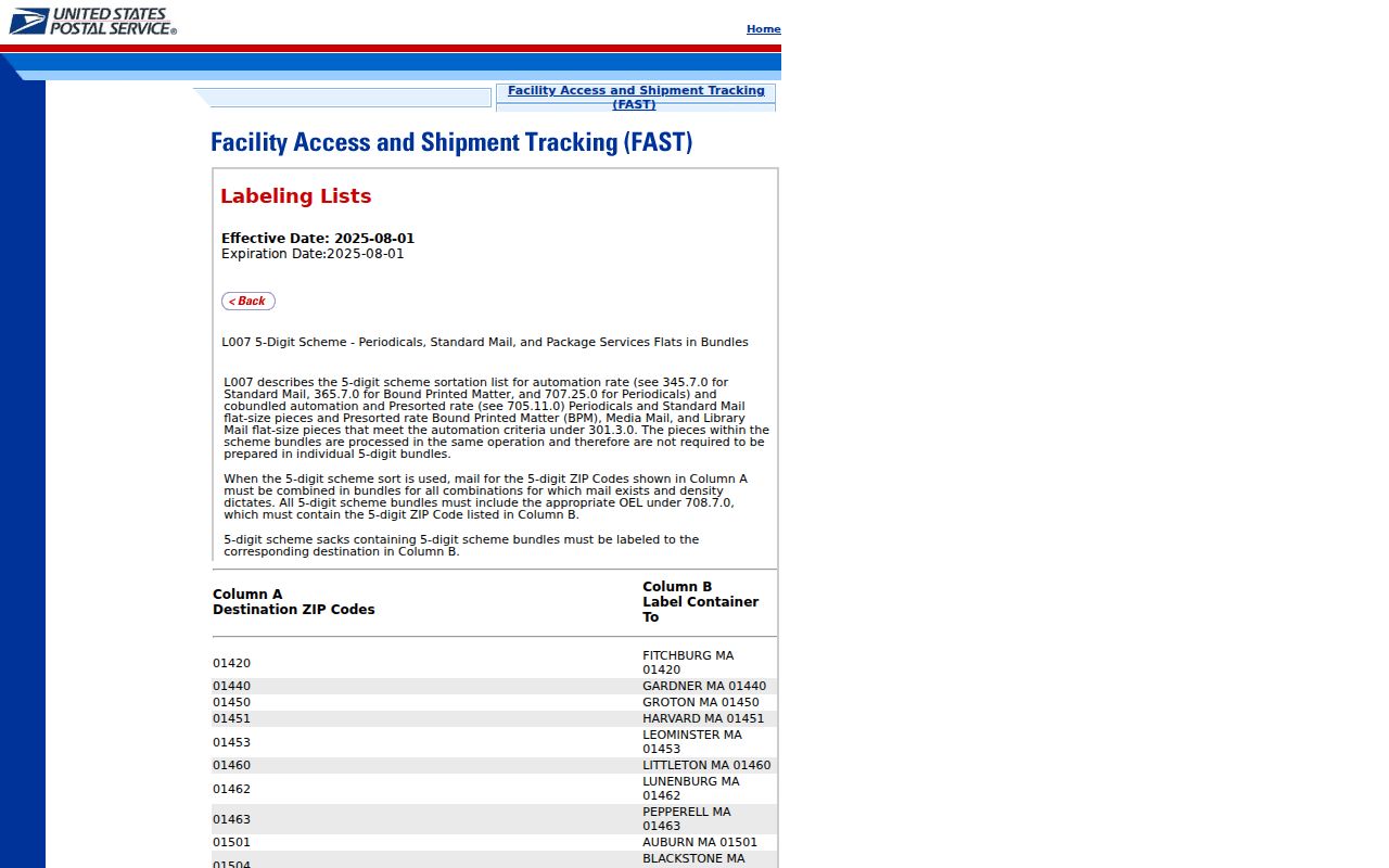
The list is evidence of a Midland postal association, not an official local ZIP boundary map.
Verify Midland ZIP Codes With USPS
For a real street address, the USPS ZIP Code Lookup Tool is the authoritative route in this Midland ZIP code directory. It accepts a residential or corporate street address, city, and state. The USPS Locations tool accepts city and state, ZIP, street address, city or ZIP, and state, then offers filters such as Post Office, collection box, contract postal unit, self-service kiosk, and Village Post Office. Each tool answers a postal question, not an ownership or city-limit question.
| Street address | Enter the full delivery address when validating a ZIP code. |
|---|---|
| City and state | Use Midland and Texas with the address in the USPS lookup. |
| ZIP or city/state | Use either in the Locations tool to find a postal facility. |
| Location type | Filter the Locations result by the type of postal service needed. |
A USPS result can settle the mailing ZIP for a given address. It cannot tell whether a site is inside the City of Midland, which subdivision it occupies, or who is connected to it. Those are separate map and record questions.
The USPS Locations finder provides the postal facility search used alongside address verification.
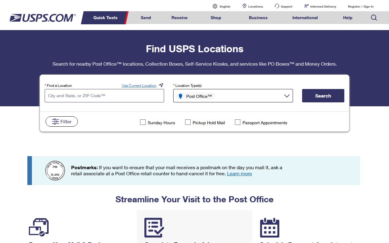
Use the location finder for a facility or service type, then return to the address lookup for the delivery ZIP.
Use a Midland ZIP Code for Research
A ZIP code narrows a place, but it does not produce a public Midland resident roster. Begin with a full address when one is available. The official tools serve different purposes: USPS validates delivery, City GIS supplies map context, the county appraisal search offers text-based property clues, and the state HOA certificate search accepts ZIP as a filter. The voter-file form can reduce output by Texas mailing address and county, district, or precinct filters, but it is not a public ZIP list.
- Validate the street address and ZIP with the USPS lookup before copying it into another record search.
- Use the City of Midland GIS map inventory for city limits, streets, subdivisions, annexations, and other map context.
- Search the Midland Central Appraisal District (MCAD) tax-account page by the known property location or owner-address text, not by an assumed ZIP filter.
- For a named community, search the Texas HOA management-certificate database by county, city, or ZIP.
- Once the ZIP points to a particular street, use the Midland street address directory for the fuller street-level record trail.
This order avoids treating one label as all-purpose evidence. It also keeps a postal search from becoming an unsupported claim about a parcel or a person.
MCAD Is Not a Midland ZIP Directory
Insider tip: The MCAD search page does not show a separate ZIP search control. Its visible search uses property-location text and owner-address text, along with account-number formats, account type, inactive-account, and paid or unpaid controls. The site’s own hint emphasizes street number and street name. Adding a ZIP suffix to a text search may help form a query, but it does not turn the Midland Central Appraisal District into an official ZIP directory or confirm a delivery boundary.
MCAD also distinguishes an owner mailing address from a property location. That difference matters when a postal label is being compared to a tax account. A mailed notice can use one address while the property-location field uses another. The research did not capture a parcel card, so fields beyond the visible search controls should not be assumed. For a current account question, verify what a live result actually displays.
Note: A tax-account result can provide property research clues, but it is not proof of present occupancy or a postal assignment.
Midland ZIP Codes Do Not Set City Limits
Myth: a Midland ZIP code draws the City of Midland boundary. It does not. ZIP codes are postal routing units. A Midland mailing address can be outside city limits, and an address inside a city-limits map can receive a different USPS label. City GIS offers annexation, street-index, city street, county road, ETJ, subdivision, voting-precinct, and zoning maps that help explain the mismatch. No official Midland ZIP-boundary shapefile or ZIP-to-parcel crosswalk was located in the inspected sources.
- ZIP code
- A postal routing label used for delivery, not a municipal or parcel boundary.
- ZIP+4
- An added four-digit delivery segment that refines the base ZIP for a particular address or postal location.
- PO-box ZIP
- A ZIP used for post-office boxes, which does not describe a street-address boundary.
- Carrier route
- A delivery route used by the postal service; it is not a public list of people.
Midland ZIP+4 Locations in Context
Official facility records offer concrete examples of how ZIP+4 labels work without defining residential coverage. Downtown Midland is at 100 E Wall St and uses 79701-9998. Claydesta is at 612 Veterans Airpark Lane and uses 79705-9998. The Midland GMF is at 10000 Loop 40 and uses 79711-9996 and 79711-9998. Village is at 2315 W Louisiana Avenue and uses 79701-9997. These are postal-location examples, not evidence about nearby addresses.
USPS’s Downtown Midland location record displays the 79701-9998 example.
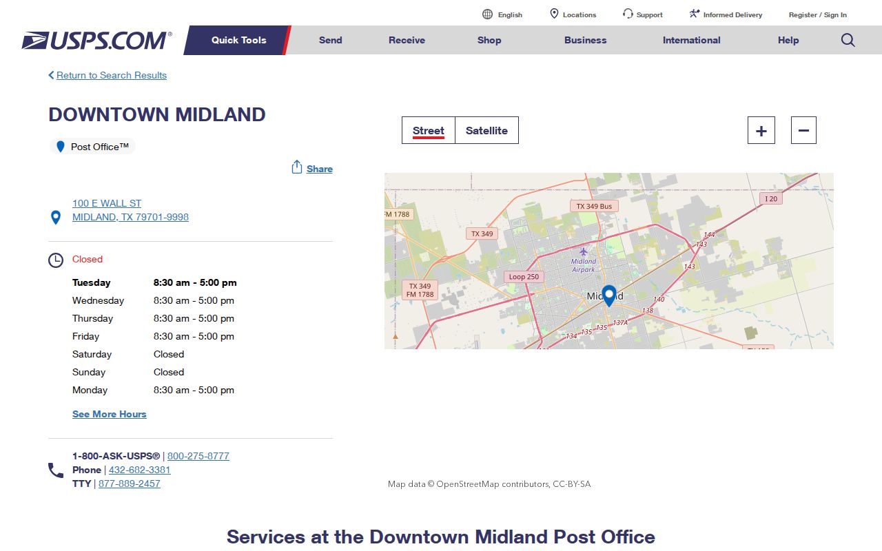
Downtown’s ZIP+4 is tied to that postal facility record and should not be projected across the surrounding map.
USPS’s Midland GMF location record gives the 79711 facility example.
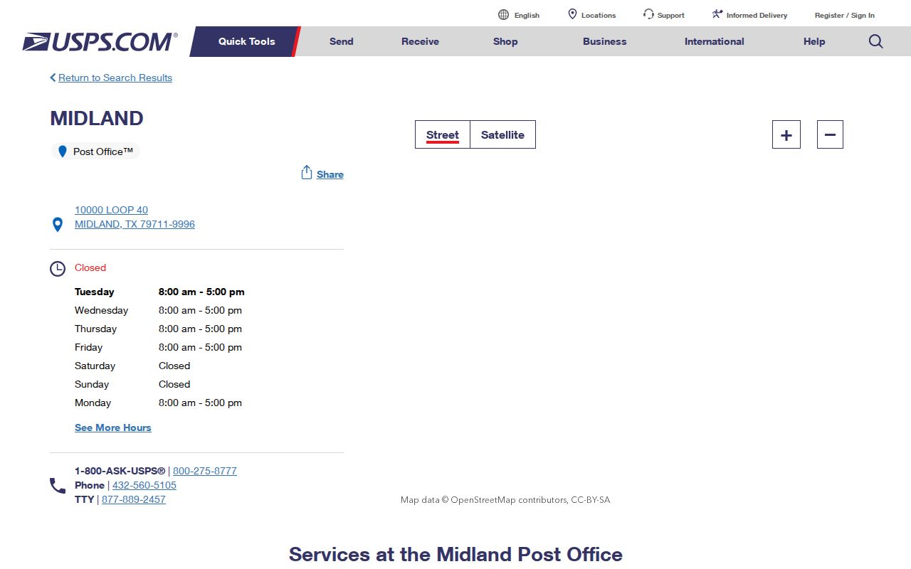
The GMF label illustrates why a base ZIP and a ZIP+4 should be recorded exactly as returned by USPS.
Midland ZIP Labels and Subdivision Names
Neighborhood and subdivision labels add another geography layer. The City subdivision map names places including Green Tree North, Briarwood, Fairmont Park, West End, Permian Estates, Vineyard Addition, Northgate, and Midland Airpark. HOA search results associate some named communities with 79705, 79706, and 79707. Those associations can help a researcher form a question, but they do not establish that every address with the label sits in the same ZIP or belongs to the association.
Use the subdivision map for the local name, USPS for delivery, and the appropriate property record for the parcel. A ZIP may overlap a city label, subdivision label, county mailing label, or association reference without being identical to any of them. This is particularly important when an address appears differently in a historical directory and a current postal lookup.
Midland ZIP Research Needs Two Dates
Historical address work needs both the directory date and the date of the postal check. UT Austin’s directory index can help locate a Midland city or telephone directory by year, but a directory entry is a dated snapshot. USPS verifies current delivery information for the address submitted. Do not assume a current ZIP label was printed in an older volume, and do not use a current label to rewrite a historical street entry.
When records disagree, keep the exact address string from each source. Compare the street on the City GIS map, then seek a deed or plat for a legal-boundary question. The research found no local authority that crosswalks every Midland parcel to a ZIP. That gap is meaningful: it is a reason to verify each address, not a reason to invent a clean ZIP boundary.
Note: A postal match is best used for mail delivery; city limits, parcel identity, and historical location require their own official sources.
Match Midland ZIP Questions to Custodians
When an address is difficult to reconcile, save three independent views instead of forcing one label to win. Keep the USPS ZIP result for delivery, the City GIS view for city-limit, subdivision, parcel, and street context, and the MCAD property-location string for the appraisal account. If those labels differ, that is not automatically an error. It can reflect a delivery boundary, an annexation or extraterritorial jurisdiction (ETJ) setting, a subdivision name, or the difference between a situs address, meaning the property-location address, and a mailing address.
The source hierarchy matters. USPS answers the ZIP question. City or county GIS provides map context. A deed or recorded plat supplies the legal-boundary source. MCAD speaks to the appraisal or tax account. No official Midland ZIP-to-parcel crosswalk was located, and the live CAD parcel viewer did not yield a verified field inventory during the research. An exact-address issue should therefore be verified at each custodian rather than resolved by a broad ZIP map or a single text-search result.