
Trace a Midland Street by Address
A Midland street search works best as a short chain, not as a roster. Begin with the site address in the appraisal search. Then use the parcel and subdivision layers to make sure the location is the intended one. Recorded instruments can connect legal parties and dates to that parcel, while city permit material can supply a separate date for work or an inspection. A voter result or historical directory may add a dated association, but neither turns the chain into a current occupancy list.
- Enter the address in the Midland Central Appraisal District property-location search. Keep the result separate from an owner mailing address.
- Use City GIS parcel, street, and subdivision layers to check the physical location and nearby map context.
- Record the legal description, account clue, and any party name before searching the County Clerk index.
- Search the Clerk by party, legal description, document date, book or page, or instrument number, then retain the recording date and document number.
- Check Permit Midland for a matching address when a dated permit, plan, inspection, code case, request, or license could clarify the timeline.
- For a past association, compare the closest available directory year and newspaper context through the local genealogy and archive channels.
Each link answers a different question. The appraisal account is a tax-record clue, the deed index is a legal-record clue, and the map is spatial context. That distinction keeps a Midland street directory search careful when names, mailing addresses, and site addresses do not match.
Search Midland Streets in MCAD
Midland Central Appraisal District's tax-account search is the practical first screen for a Midland address. Its instructions distinguish the property location, also called the situs address, from the owner address used for mail. For a property location, the observed hint says to enter the street number and street name without a street type or direction. That local formatting detail can prevent a miss when an address is written in a more complete postal form elsewhere.
The Midland Central Appraisal District image below is the page assigned to this Midland street directory. It points to the local appraisal source rather than a general people listing.
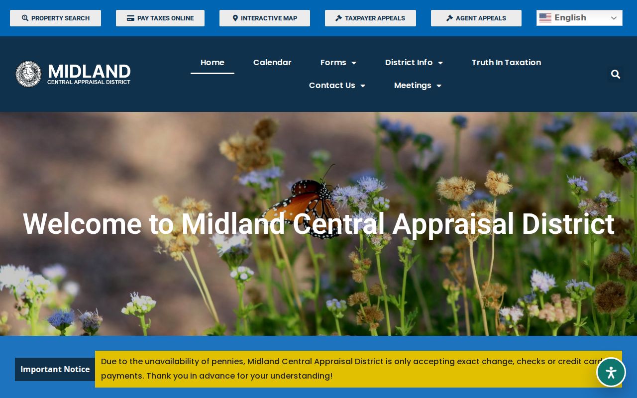
Use the search result as an address and account lead, then confirm legal ownership through the recorded instrument. The inspected screen did not reveal a parcel-card schema, a street-browse control, or a ZIP filter, so those features should not be assumed.
| MCAD control | How the Midland address search uses it | Observed guidance |
|---|---|---|
| Search By | Chooses the type of search | A dropdown is visible; its full choices were not captured. |
| Search text | Accepts the selected search value | Owner names use last name plus first name or initial. |
| Property location | Looks for the situs address | Use number and street name, omitting type and direction. |
| Account Type | Limits the account category | A dropdown is visible; options were not captured. |
| Include Inactive Accounts | Controls inactive-account inclusion | Yes and No radio choices are shown. |
| Pay Status | Filters account payment status | Both, Paid, and Unpaid are shown. |
Note: An MCAD owner clue and a property-location clue can point to different addresses, so preserve the label shown with each result.
Midland Street Directory Terms
Address records use terms that look alike but serve different functions. Define them before comparing sources. A mismatch can be a change in mailing information, a map label, or a street-format difference rather than a conflict in the underlying land record.
- Parcel
- A mapped unit of property used in appraisal and map work. It is a useful locator, not by itself a proof of occupancy.
- Situs address
- The property location used for the place itself. MCAD distinguishes it from the address used to mail the owner.
- Plat
- A recorded map or plan that describes lots, blocks, and subdivisions. It is stronger for legal layout than a GIS display.
- Criss-cross directory
- A directory arranged by address rather than only by name. Midland holdings should be confirmed with the repository before relying on a specific run.
For an older Midland address, the legal description and the year of the record are often steadier comparison points than an abbreviated street line alone.
Map a Midland Street in GIS
City of Midland GIS Mapping supplies a second layer for a street directory search. GeoStation lists parcel, subdivision, zoning, city-limit, council-district, building-footprint, street, floodplain, utility, park, school, and aerial layers. Those layers help identify whether two address references sit on the same parcel or within the same named development area. They do not replace a plat, deed, survey, or certified boundary.
The assigned Midland Development Services image shows the city department that brings permit, planning, code enforcement, GIS, and public-information functions together.
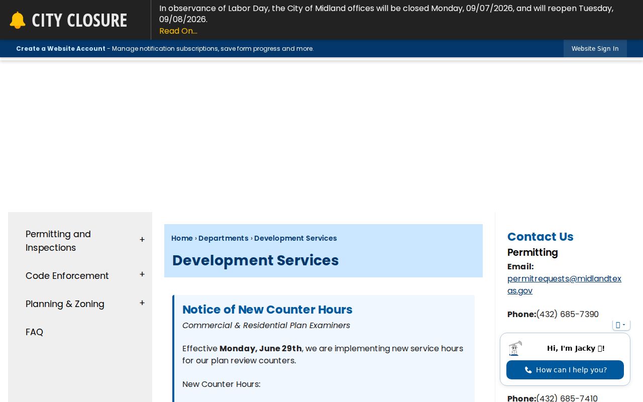
City GIS warns that its data may not be current or complete and is not the primary tool for permitting, citing, or decisions. Use it to locate and compare, then return to the custodian that owns the record needed. That division of roles is especially important when a Midland parcel has several map labels.
Midland Street Directory Record Trail
Several Midland records can be keyed to an address, but they carry different levels of proof. The best practice is to save the source, date, and record type with every finding. This prevents a map label, a tax account, or a filing party from being presented as more than it is.
| Address-linked source | Midland key | What it can support | Access and limit |
|---|---|---|---|
| MCAD tax account | Property location or owner address | Account and owner clues | Online search; exact parcel-card fields were not captured. |
| City GIS | Parcel, street, subdivision, and map layers | Geometry and local context | Public map; not a certified legal source. |
| County Clerk Official Records | Party, legal description, lot/block, book/page | Recorded instrument parties and dates | Public index; ordering or images may be gated. |
| Permit Midland | Keyword or address | Permit, plan, inspection, code, request, or license activity | Public search; it is not an occupancy list. |
| Texas voter services | Official voter lookup methods | Registration information within legal limits | Protected address and identifying fields remain protected. |
| Historical directories | Street number and street name | A dated name-and-address association | Archive or library access; not current evidence. |
When the issue is a legal transfer, use the Clerk. When it is a physical map question, start with GIS. When an address has an old spelling or number, compare it against a nearby directory year and a map before treating it as the same location.
Midland Street Records in the Clerk Index
Midland Official Records Quick Search accepts an optional Search Term, a recorded-date start and end date, date shortcuts, and a choice between Index Only and Index & Full Text. The quick page displayed certification through August 31, 2026. That is a freshness observation, not a stated earliest year for the online index. The clerk has not published the online start year in the inspected material.
The assigned Official Records Quick Search image documents the search screen used for this Midland street directory research.
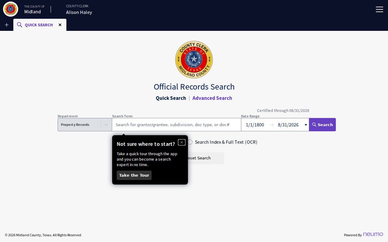
Start with the narrowest known term. A legal description, subdivision, or recorded party can be more useful than an informal street phrase. Write down the document number, instrument type, and recorded date before asking the Clerk for a copy.
Midland Street Directory: Index or OCR
Insider tip: Midland's quick recorder page offers two search scopes. Index Only can search multiple words individually, while Index & Full Text searches phrases in the OCR text of documents. Try the index first when a party name, subdivision, or document type is known. Use OCR as a second pass for a distinctive phrase, then verify what the original filing actually says.
Midland Official Records Advanced Search adds department, party or grantor/grantee, instrument-date and recorded-date ranges, document type and number, book, volume, page, lot, block, legal description, and document-image phrase fields. The full document-type list, result layout, image price, export behavior, and online start year were not located.
The assigned advanced-search screen shows the additional controls available for targeted Midland parcel research.
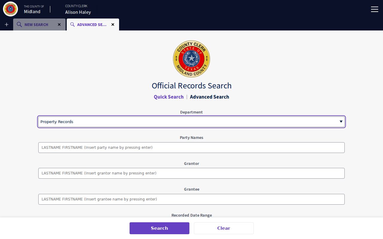
Advanced fields support a careful deed-chain search, not a shortcut to a household list. A grantor, grantee, lien party, or attorney-in-fact has a record role that must be read in context.
Midland Address Activity Through Permits
Permit Midland adds a municipal record layer to a street directory workflow. Its public-information search has an All dropdown, a keyword or address field, an Exact Phrase checkbox, Search, and Reset. The search reaches permits, plans, inspections, code cases, requests, and licenses. It can help place work or an action on a timeline, but an applicant, contractor, or request contact should not be assumed to be a resident.
Submissions require registration. Development Services also routes city public-information requests, while Code Enforcement accepts a violation address and nature through phone, mail, in person, or SeeClickFix. For another city-held record, use the City of Midland public-records request center rather than sending a land-record question to the wrong office.
Note: A permit or code result supplies dated address activity, while the County Clerk remains the custodian for recorded property instruments.
Midland Streets Are Not ZIP Boundaries
Myth: a postal ZIP identifies a parcel's legal location. It does not. A street can cross postal, subdivision, city-limit, and appraisal labels that serve different purposes. Use the USPS ZIP Lookup for the delivery ZIP, City GIS for map context, MCAD for appraisal language, and a deed or plat for the legal property description.
Named map areas such as Green Tree North, Briarwood, Fairmont Park, West End, and Permian Estates are useful geographic labels. They are not proof of a common legal boundary or an association roster. Keep the source hierarchy clear when a Midland address appears under more than one label.
Historic Midland Street Clues
Older street research needs a different set of tools. The Midland County Genealogy service at the Redfern Genealogical Research Center has newspapers, microfilm, genealogy material, and house-history assistance. The Midland Historical Society archives are available by appointment. Texas State Library and UT Austin directory catalogs add year-specific leads, but the catalog runs do not perfectly match. Treat an unverified directory year as a lead, not a confirmed address entry.
For the historical collections themselves, use the Midland city-directory collections. Compare a number, street spelling, cross-street context, and publication year before merging an older listing with a modern parcel.
Limits of a Midland Street Directory
No Midland street directory is a complete list of everyone at every address. Deeds identify recorded parties and interests. Appraisal accounts supply tax-related clues. GIS draws spatial context. Permits document municipal activity. Voter information has defined public fields and strict protections, including confidential addresses and identifiers. A result should be confirmed with its custodian before it is used for family history, estate work, civic research, or correcting an address record.
Lawful use. Midland street and address records are for personal, lawful research. Do not use them to stalk, harass, intimidate, or harm anyone, and do not try to identify a protected address.
When online access stops short, the County Clerk's Land and Vital Statistics counter is at 500 N Loraine Street, fourth floor, and can be reached at 432-688-4401. A targeted copy request naming the record, date range, address or party, and whether certification is needed is more useful than an unsupported claim about a street.
For mail or counter follow-up, keep the same address format, party name, and date range used online. The Clerk page does not publish a separate online deed-copy form or a stated turnaround, so a focused request is the documented fallback when an index entry needs a copy or certification.